Log in
All resources
Create a design
154 Free Images of Atlas Van Loon
maps by willem and johannes blaeu
sconces in the netherlands
coats of arms on maps
17th-century fortress plans
circumvallation
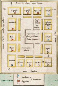
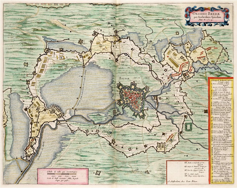
siege of breda 1624-1625
map of maastricht by willem and johannes blaeu (1649)
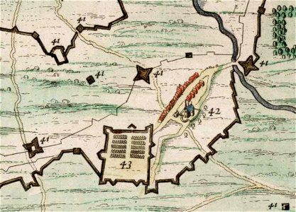
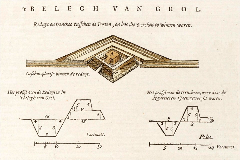
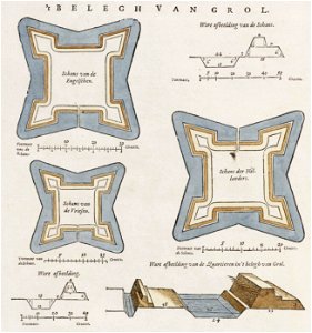
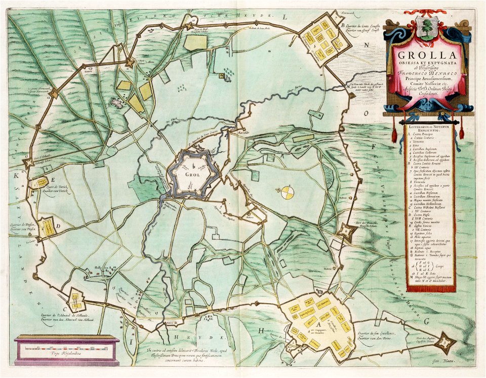
siege of groenlo 1597
fortifications of the eighty years' war
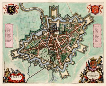
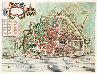
old maps of breda
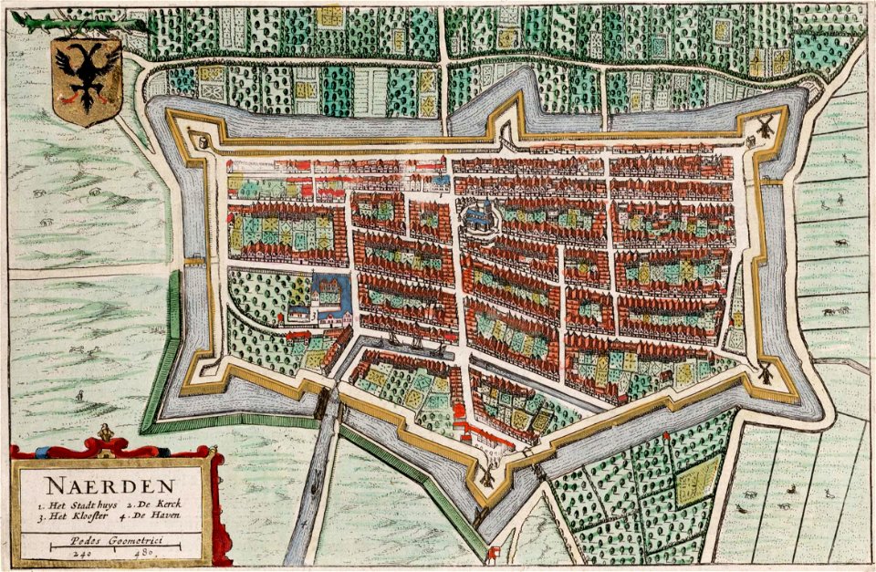
old maps of naarden
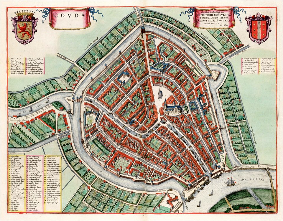
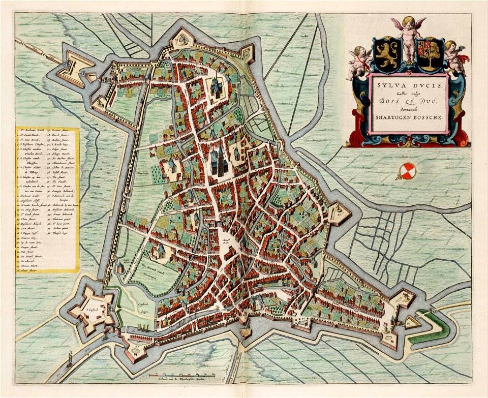
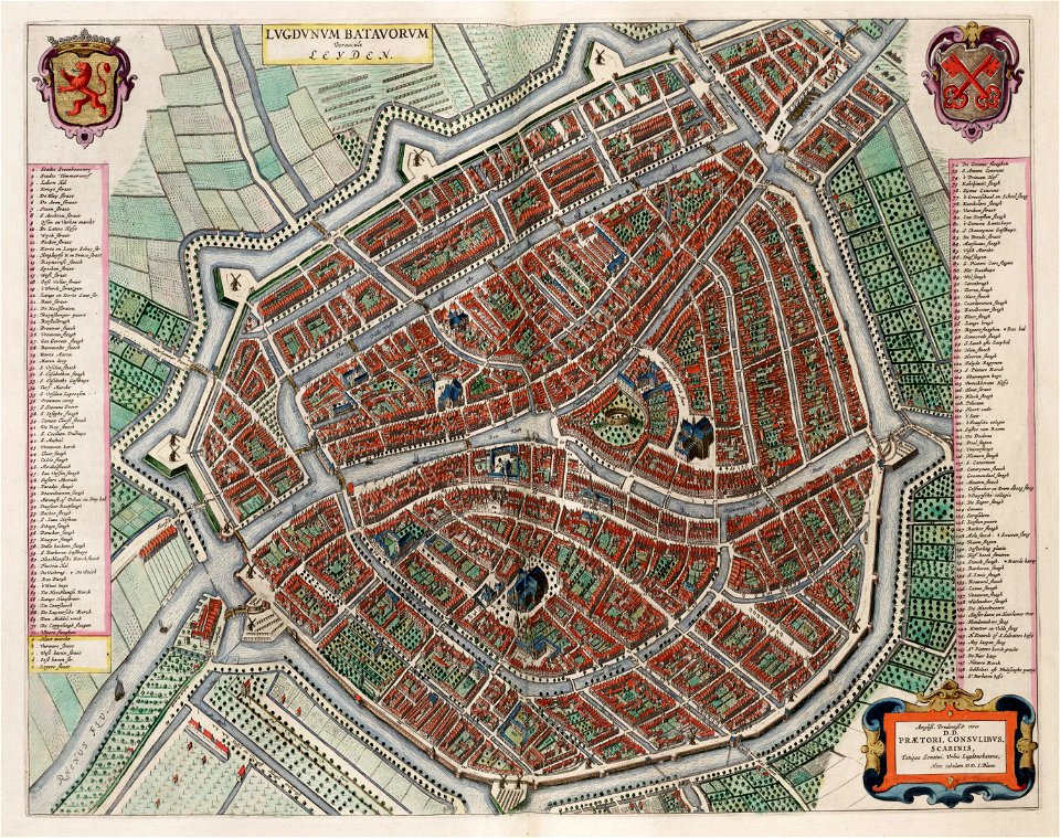
atlas van loon
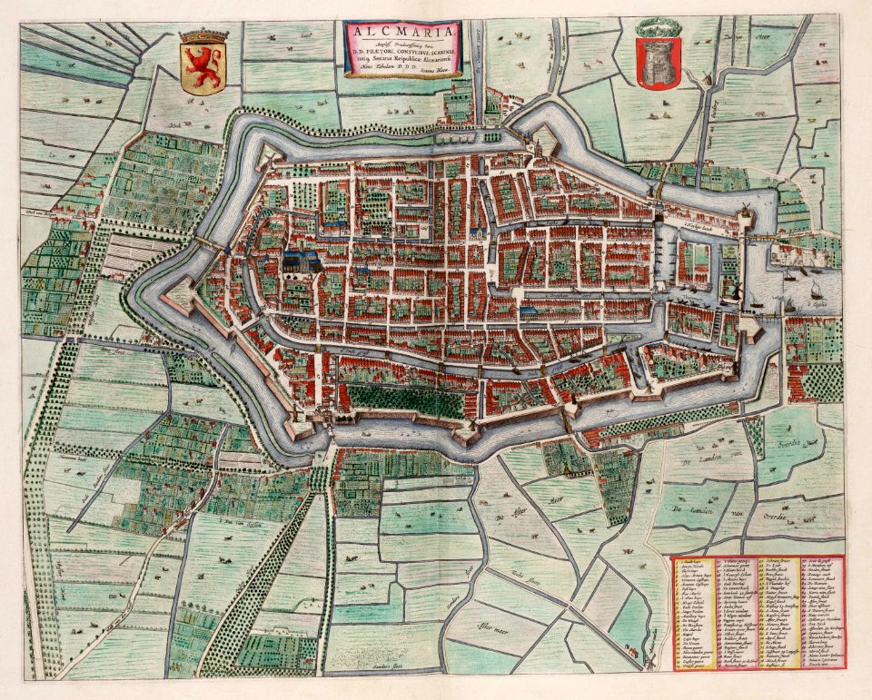
old maps of alkmaar
atlas van loon
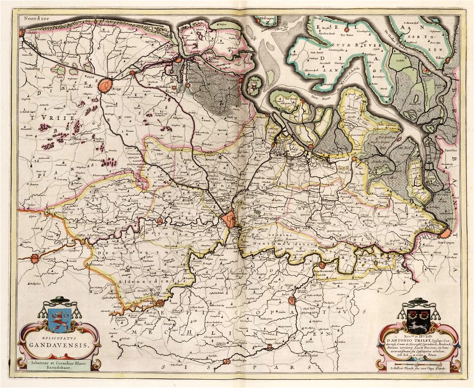
old maps of ghent
atlas van loon
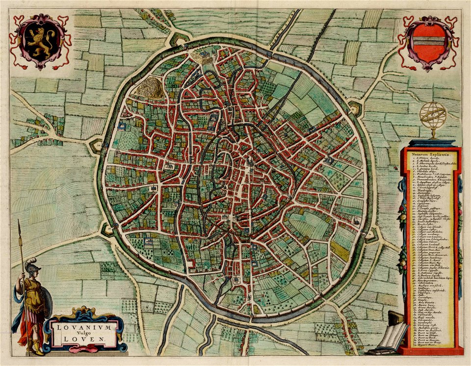
old maps of leuven
atlas van loon
johannes blaeu - map of antwerp
atlas van loon
old maps of lower saxony
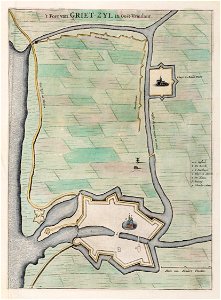
greetsiel
atlas schoemaker-noord-brabant
atlas schoemaker
historical images of the gravensteen (ghent)
atlas van loon
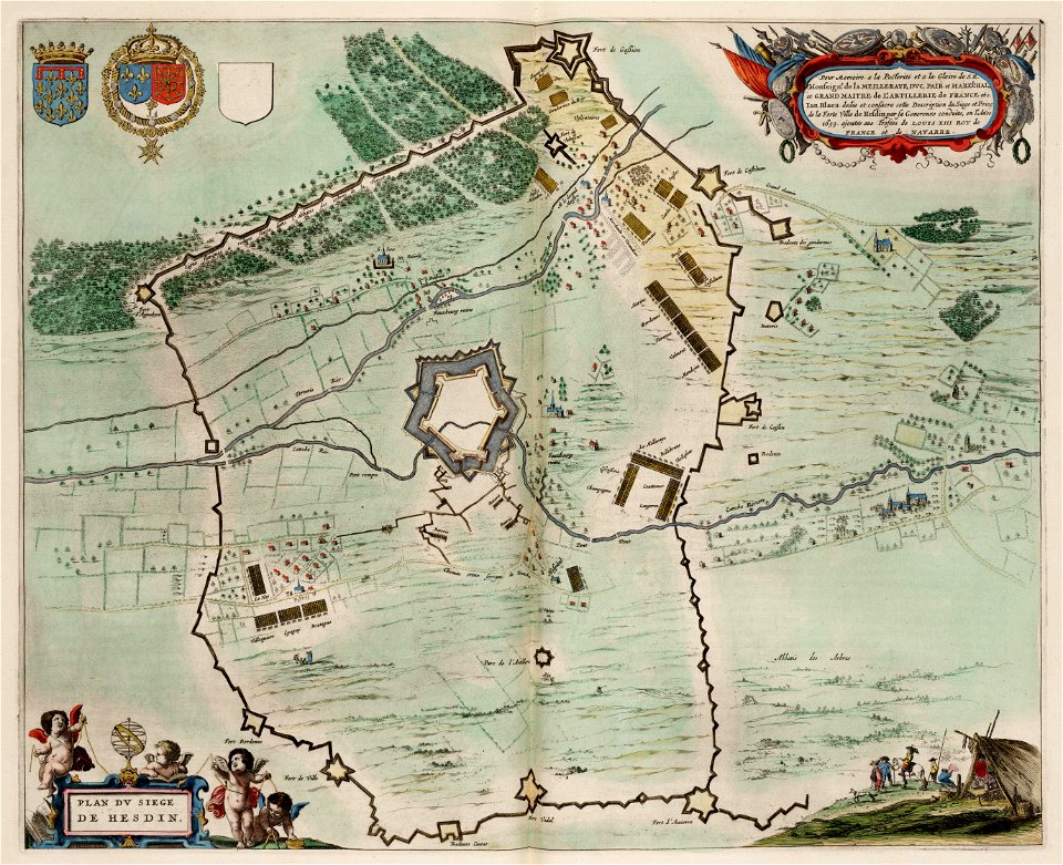
maps of hesdin city walls
circumvallation
coats of arms of breda
netherlands
atlas schoemaker-zuid-holland
atlas schoemaker
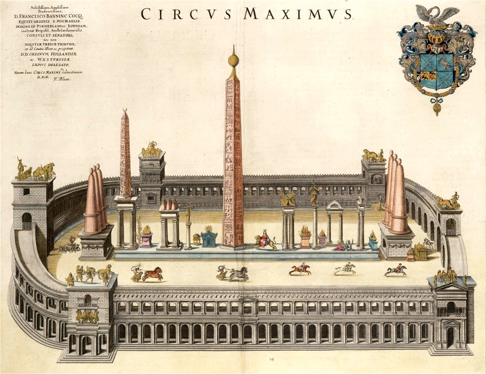
flaminio obelisk (rome) in art
circus maximus (rome) in art
maps by willem and johannes blaeu
wijnhaven, the hague
siege of breda 1624-1625
atlas van loon
siege of breda 1624-1625
atlas van loon
siege of breda 1624-1625
atlas van loon
siege of breda 1624-1625
atlas van loon
map of ghent by jan blaeu
atlas van loon
siege of breda 1624-1625
atlas van loon
maps by willem and johannes blaeu
atlas van loon
maps by willem and johannes blaeu
atlas van loon
atlas van loon
atlas beudeker
maps by willem and johannes blaeu
atlas van loon
maps by willem and johannes blaeu
old maps of rotterdam
dutch-language maps
atlas van loon
maps by willem and johannes blaeu
atlas van loon
atlas van loon
simon stevin
maps by willem and johannes blaeu
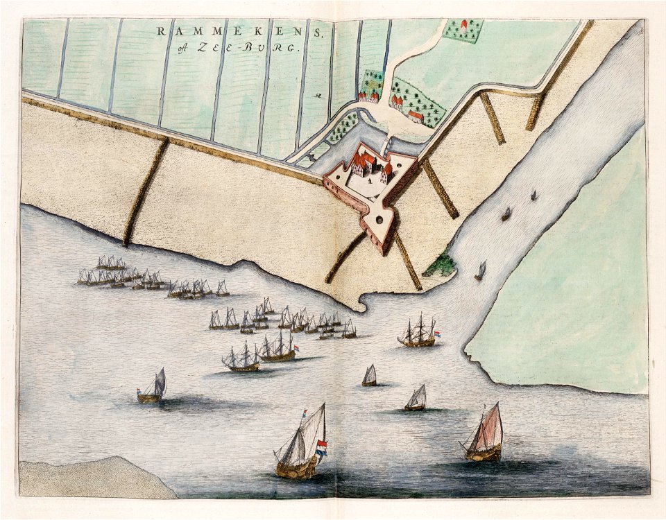
coats of arms of zeeland
old maps of bredevoort
atlas van loon
windmills in art
bridge of arts
old maps of bredevoort
1597
old maps of the hague
the hague
map of maastricht by willem and johannes blaeu (1649)
tongersestraat (maastricht)
maps by willem and johannes blaeu
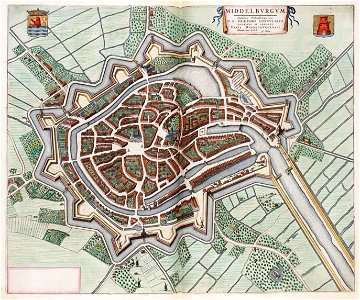
old maps of zeeland
map of maastricht by willem and johannes blaeu (1649)
nieuwenhofpoortje
map of maastricht by willem and johannes blaeu (1649)
nieuwenhofwal (maastricht)
military trenches
atlas van loon
claes jansz. visscher (ii)
circumvallation
first medieval city wall of maastricht
history of vrijthof (maastricht)
siege of groenlo 1627
atlas van loon
maps by willem and johannes blaeu
circumvallation
maps by willem and johannes blaeu
circumvallation
circumvallatielinie (groenlo)
coats of arms on maps
coats of arms of breda
netherlands
maps by willem and johannes blaeu
ravelins
maps by willem and johannes blaeu
17th-century fortress plans
maps by willem and johannes blaeu
atlas van loon
maps by willem and johannes blaeu
atlas van loon
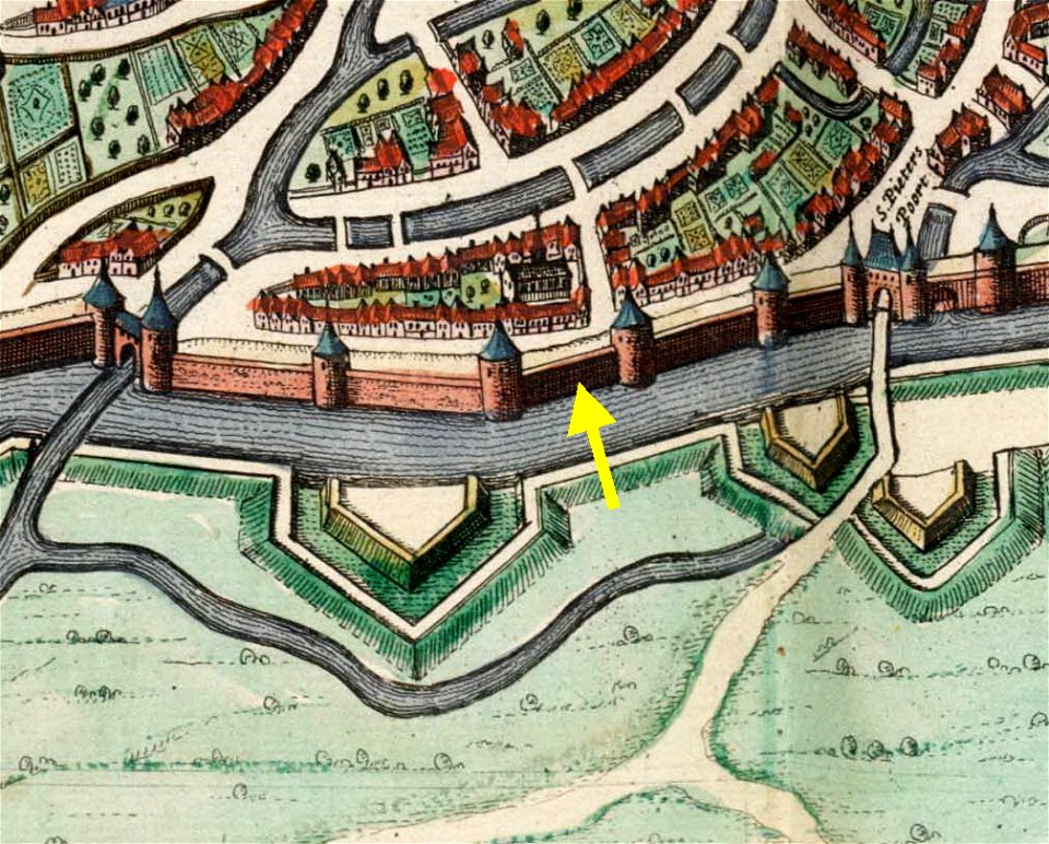
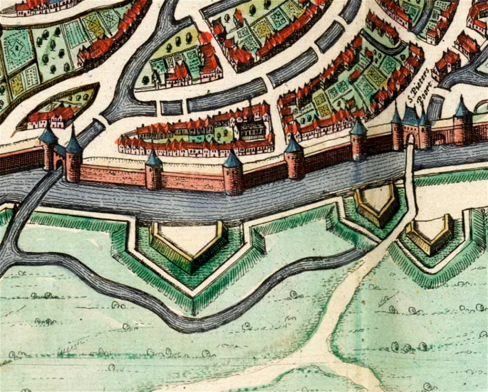
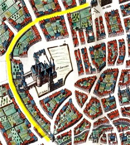
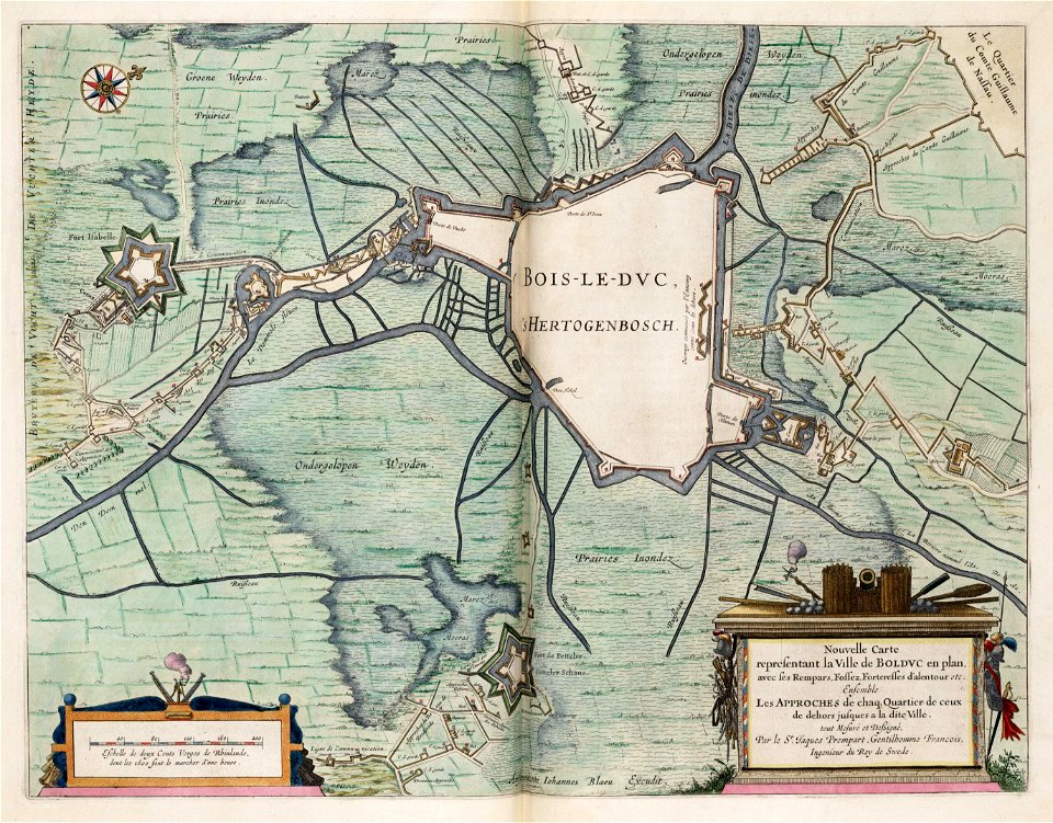
maps of utrecht (city) city walls
old maps of utrecht (city)
maps by willem and johannes blaeu
atlas van loon
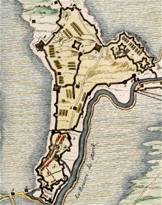
maps of hulsterse bolwerken
old maps of hulst
stonehenge in art
atlas van loon
vesting bourtange
atlas van loon
old maps of kreis kleve
history of geldern
atlas van loon
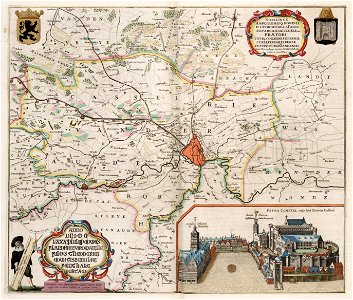
festung jülich
fortifications of the eighty years' war
atlas van loon
sconces in belgium
lillo
fortifications of the eighty years' war
sconces in the netherlands
atlas van loon
fort-mardyck
old maps of dendermonde
atlas van loon
rheinberg in the 1640s
atlas van loon
old maps of delfzijl
atlas van loon
atlas van loon
1664 maps
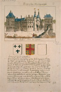
muiderslot historical view
atlas van loon
maps of steenbergen
fort henricus
maps of cambrai city walls
old maps of cambrai
old maps of arnemuiden
atlas van loon
old maps of arnhem
atlas van loon
old maps of vlissingen
atlas van loon
old maps of haarlem
atlas van loon
old maps of bolsward
atlas van loon
old maps of blokzijl
atlas van loon
maps of amersfoort by braun & hogenberg
atlas van loon
maps of bruges by jan blaeu
atlas van loon
old maps of culemborg
atlas van loon
sconces in belgium
fort liefkenshoek
old maps of zwolle
atlas van loon
maps of tournai city walls
old maps of tournai
maps of oudenaarde city walls
old maps of oudenaarde
old maps of coevorden
atlas van loon
atlas van loon
kuinderburcht
1660s maps of belgium
old maps of bruges
siege of zaltbommel 1599
1599 in the netherlands
atlas van loon
maps of sieges
palace of coudenberg
atlas van loon
historical
history
siege of hulst 1645
atlas van loon
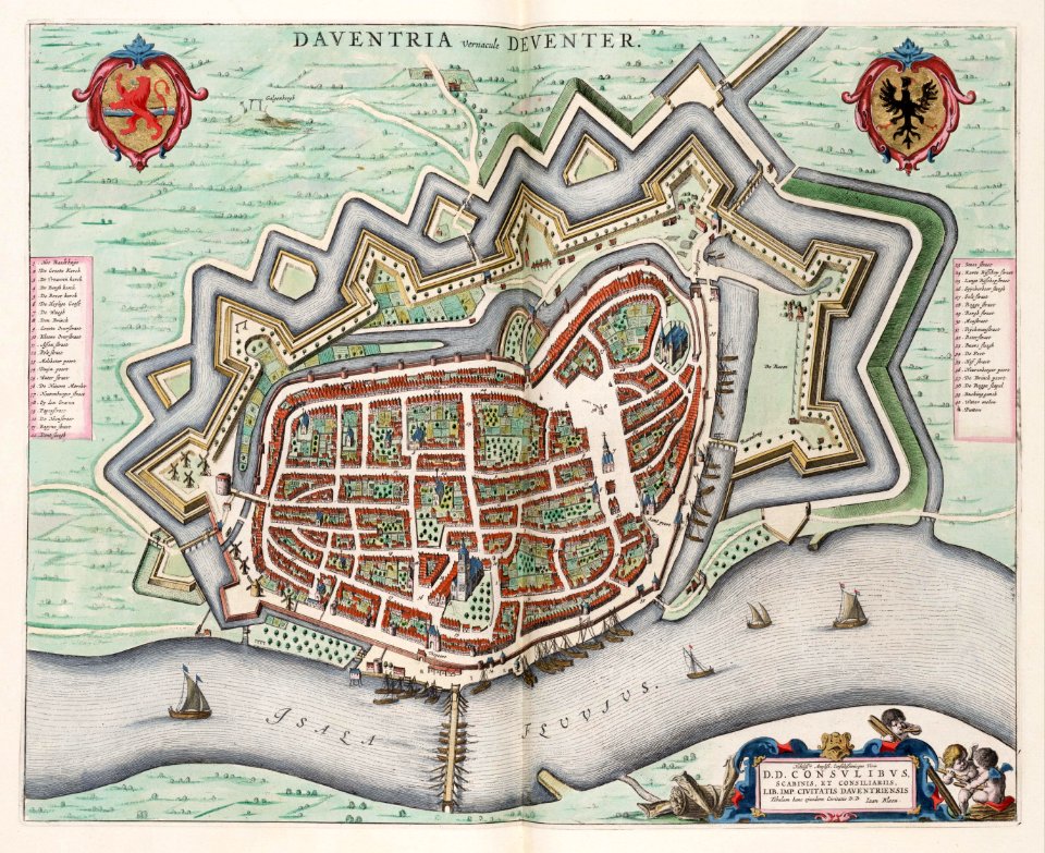
old maps of deventer
schipbrug deventer
map of maastricht by willem and johannes blaeu (1649)
meuse river in maastricht
maps by willem and johannes blaeu
atlas van loon
old maps of grave, netherlands
atlas van loon
maps of heusden, north brabant
atlas van loon
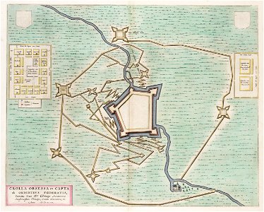
siege of geertruidenberg 1593
maps of geertruidenberg
old maps of enkhuizen
atlas van loon
old maps of westerwolde
maps of vlagtwedde
1602 in the netherlands
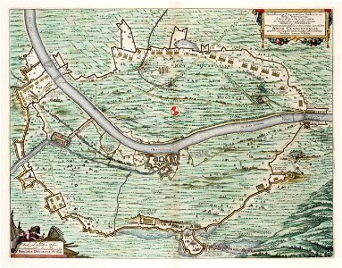
siege of grave 1602
17th-century maps of maastricht
siege of maastricht (1632)
old maps of delft
atlas van loon
siege of steenwijk 1592
maps of steenwijk
17th-century maps of moscow
atlas van loon
1 - 100 of 154
Next page
/ 2